

WASHINGTON — In a dramatic escalation in the growing trade war with Canada, President Donald Trump has signed an executive order requiring all U.S. cartographers, textbook publishers, and GPS software companies to immediately shrink the geographic footprint of Canada by exactly 50% on all official U.S. maps.
Only days after renaming Lake Ontario to “Lake America,” Trump said the move was necessary after Canada continued resisting his demands in the escalating trade dispute, arguing that the United States needed to take decisive action against a country that had become far too big and far too confident.
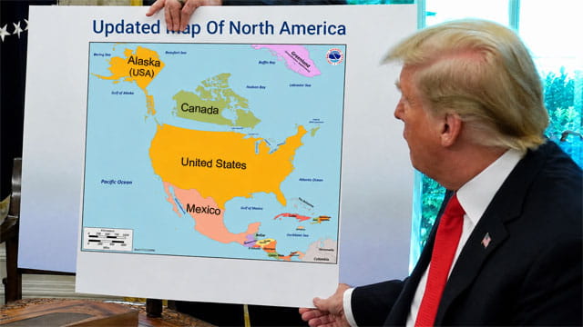
“They’ve been acting very big and very tough lately, so we decided to make them a lot smaller,” Trump announced from the Oval Office, showing White House reporters the updated map of North America. “They’re huge. Frankly, Canada is much too large. For too long, Canada has had an enormous amount of land. A tremendous amount of land. It’s not fair, so we’re shrinking them.”
Canadian Prime Minister Mark Carney condemned the move as an unprecedented attack on Canada’s territorial integrity, though he acknowledged that he was not entirely certain whether the president could actually make a country smaller simply by changing its size on a piece of paper.
“I would assume that’s not how geography works,” Carney said. “But frankly, I don’t know anymore. Maybe if you make Canada 50% smaller on enough maps, eventually the physical Canada becomes 50% smaller too. Our scientists are looking into it.”